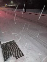
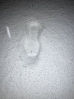
Sat 1/15 and 1/16 winter event in South Carolina

Does this winter cycloneacane have a name yet?

Sounds like the one that came through the PNW and finally made it your way. We just call them winter storms.
No thank god! Maybe once it gets up into the Northeast (no politics) they will make up a name for it to make it sound sensational!

You gotta love the new name up north, called a BOMB CYCLONE !!!!
Talk about idiots listening to this garbage from the media. Drives me nuts! You wont see that happen in the south, YET, unless we keep getting invaded from up north and I am a northerner but I got out of there because of this stupid stuff.
Think about that, "Bomb Cyclone" nothing like putting the word "bomb" in there to make it sound serious and deadly, as seemingly people are looking for in the news today = despair and misery.

You dont have where you live, BUT one day this stuff might happen to your area too, "snowflake" generation, hand them a snow shovel and they may not know what to do with it. 🙃

It is a bigger deal in the south, we do not have equipment to get rid of it or melt it. About 10 years ago we got 5 or 6 inches of snow here, schools were closed for a week as there was no way to get the ice and snow out of the school parking lots and it makes sense, why tax the people for equipment that will never be used, except once every decade or so? Its what is great in the South, low taxes and COMMON sense works for me.
 
Last edited:
Living in the Midwest,this is just another winter for us. Learn to adapt and overcome, otherwise move. It's as simple as that.
 
I don’t watch the news, one has to realize they are in the news business to make money, can’t make money if you don’t tune in and stay tuned in, no matter the subject.
So the common people in the world watch the news for entertainment and the news media gives them that. I think pretty darn scary.
I rely on the “source” and for the weather and that is NOAA.GOV
The map I posted did come from the local news outlet but that is a map of NOAAs forecast and here we are Sunday 11AM and amazingly NOAA.GOV was just about slam dunk 100% accurate.
Pretty impressive to be calling a forecast where ONE degree makes all the difference in an ice storm vs sleet and rain.
Pretty safe to say 10s of thousands without power and other areas with significant/sleet/snow in a state that see’s this stuff once or twice every decade.
Local Channel 4 was spot on with the forecast. The local meteorologist Chris Justus called where to find the snow and ice as I was right on the forecasted line. Forecasting is a science, something alot of southerners disregard.
 
Up here in Ontario, we are supposed to get over 25cm of snow starting sometime early Monday morning….we will see how it goes!
 
Living in the Midwest,this is just another winter for us. Learn to adapt and overcome, otherwise move. It's as simple as that.
I don’t really see anyone complaining unless I’m missing something.
Different parts of the country, different kinds of weather that other people aren’t used to and lack of equipment to handle it.

Example would be a huge bridge in the Midwest will not stand up as good as a huge bridge in California if you have an earthquake.

Or in this case a winter storm in freezing conditions without a huge fleet of trucks to salt roads or plow snow.

…. And ALL areas all the way up through Canada can not handle a devastating ice storm.
 
Local Channel 4 was spot on with the forecast. The local meteorologist Chris Justus called where to find the snow and ice as I was right on the forecasted line. Forecasting is a science, something alot of southerners disregard.
Huh??
Where did this come from? LOL
Southerners Disregard???
Come on man!

Weatherman spin the official government report from noaa.gov which was spot on, as their own.
 
Last edited:
7PM as a follow up to my posts on page 1 regarding Spartanburg SC;

Daughter in law just sent me this photo from their house in the above post, still snowing lightly, 7PM Sunday night, Spartanburg SC
Screen Shot 2022-01-16 at 7.17.02 PM.png
 
This is actual winter weather
 

Attachments

  • D531017A-27AF-4317-8037-201A1C2401C5.jpeg
    D531017A-27AF-4317-8037-201A1C2401C5.jpeg
    70.5 KB · Views: 7
  • 1AAE26A0-5D2D-44A0-8E80-9D5047C99FFF.jpeg
    1AAE26A0-5D2D-44A0-8E80-9D5047C99FFF.jpeg
    106.8 KB · Views: 7
  • 9924CCD6-48DC-4A8D-A206-3D752B440ADF.jpeg
    9924CCD6-48DC-4A8D-A206-3D752B440ADF.jpeg
    136.9 KB · Views: 7
No thank god! Maybe once it gets up into the Northeast (no politics) they will make up a name for it to make it sound sensational!
...
It is a bigger deal in the south, we do not have equipment to get rid of it or melt it. ...
Most local roads were salted early here (west of Greenville), like Friday morning. Fleets of plow trucks were out Saturday evening, according to TV news people.
I received an email from my cable provider apologizing in advance for any outage from this storm, which they say is named Izzy.
No cable or power outage here, so far. We have sleety snow, with ice underneath.
 
Last edited:
Local Channel 4 was spot on with the forecast. The local meteorologist Chris Justus called where to find the snow and ice as I was right on the forecasted line. ...
I watched him last night. Before S.C., I lived in 4 states farther north, including the one referenced below:
Richmond Weather.JPG
 
Saw a livestream on TWC...some microphone holding halfwit standing in snowy urban road in N.C somewhere.
A lifted brotruck drives by with a polititical flag. Four letter word prominent . Comical.

Switch to another channel.. lifted brotrucks on their sides in snowfilled ditches.
Comical.

Bigger picture... sad.
 
No thank god! Maybe once it gets up into the Northeast (no politics) they will make up a name for it to make it sound sensational!

You gotta love the new name up north, called a BOMB CYCLONE !!!!
Talk about idiots listening to this garbage from the media. Drives me nuts!

What do you mean new? The term weather “bomb” is from the 1940s, and is an official meteorological term from the AMS. Bomb Cyclone was first used in the 1970s and was studied and defined in insane detail in this 1980 paper about “bombs” from MIT.


This reminds me of people thinking “Polar Vortex” is a new media scare tactic!!! Nope, also from the 1940s.


And you say the new name “up north” yet here’s the Columbia, SC NWS office also using the phrase “bomb cyclone”. Page 9

 
Last edited:
I don’t really see anyone complaining unless I’m missing something.
Different parts of the country, different kinds of weather that other people aren’t used to and lack of equipment to handle it.

Example would be a huge bridge in the Midwest will not stand up as good as a huge bridge in California if you have an earthquake.

Or in this case a winter storm in freezing conditions without a huge fleet of trucks to salt roads or plow snow.

…. And ALL areas all the way up through Canada can not handle a devastating ice storm.

More mediocre media drama, that's all it is. We had snow storms when we were kids,drifts as high as our house.

It's winter and in a few months people will be back driving normal, like total idiots.
 
What do you mean new? The term weather “bomb” is from the 1940s, and is an official meteorological term from the AMS. Bomb Cyclone was first used in the 1970s and was studied and defined in insane detail in this 1980 paper about “bombs” from MIT.


This reminds me of people thinking “Polar Vortex” is a new media scare tactic!!! Nope, also from the 1940s.


And you say the new name “up north” yet here’s the Columbia, SC NWS office also using the phrase “bomb cyclone”. Page 9


Yes...

I have read about the " polar vortex" in WPC discussions for 20+ years.. . Nothing new to me either.

A normal phenomenon that happens every year just about. Some years the polar vortex is stronger than others. And yes some years it moves farther southward than other years.

Like January 1985.... Or December 22- 25, 1983.... Or in Jsnuary 1994 .. . Or like a couple of years ago.... Nothing really unusual about that either.

Heck go back and look up what happened in the winter of 1899 I think it was off the top of my head... Incredible... Or in 1940....

I thought it was quite funny hearing moron media talking heads acting like this was a " new" weather phenomenon.

And yes it has been known about going back since the 1940s....

And yes a storm " bombing" put has been in NWS lexicon for decades.... I have read that bomb term for 20+ years too. There are actual defining characteristics in terms of dropping of atmosphere pressure in 6, 12, and 24 hours that would classify a storm has " bombing out". Like the big east coast one in January 2018 that went from 1010 mB or so down to 949 mB in less than 24 hours.. .

Another example... January 24-25 East coast snowstorm where it bombed out too.... This giving NC it's biggest snow event on record in the Raleigh and Hendersonville areas with 22 inches.

Fun side note to that event.... No one and I mean no ONE... NWS or local weather stations even predicted that storm 24 hours ahead of time. The forecast models were all wrong.... NC State did a post study that basically stated.... If models are not verifying with real world observations.... Look at your radar and satellite pictures instead.

In NWS forecast discussions I have read the bomb terminology at times... In WPC discussions I have read that term has well. Nothing remotely new there....

However.... Media talking heads started using these " inside weather " terms to either a) HYPE their stories about regular weather events or b) try to scare the beegeezees out of people.

That's true as well.

And having read and looked at thousands and thousands of GFS and NAM computer model runs.....

Amazing how many times they show a massive "bomb" type storm 6-14 days out....

That never ever happens....

The only good thing these forecast models can reasonably predict 6 to 16 days out is the overall longwave jetstream pattern... They get that right 70-80 percent of the time.

I have looked up NAO and PNA forecast patterns accuracy in forecasting..... And it's typically between 70-88 percent day 6-10.... More than that it is only 50-65 percent at best. Reason why I look up those patterns is that a negative North Atlantic Oscillation pattern typically leads to a higher than average potential for East coast snowstorms... That -NAO typically correlates with a positive Pacific North American west coast pattern.... -NAO with a + PNA is a typical set-up for East coast storms in winter.

It is the real fine details that make a big big difference in what happens in terms of sensible weather.

If a upper level shortwave drops into a developing trough and a surface low pressure inflection starts to form on a cold front... And if that upper level energy can meet up with the developing surface low pressure center... Then it will "bomb out". If that doesn't happen... Then the sensible weather is far far different.

Which by the way for the southeast states... Keep an eye out for a possible... Possible winter storm either Thursday, or Friday into Saturday....

Things could get very interesting again for this region.
 
Last edited:
Back
Top