Absolutely use paper maps, when planning. Not so much while driving.
Drove from Connecticut to Colorado, then Utah, California, Mexico, Arizona, Colorado, Wyoming, Idaho, Montana, and back to Connecticut across the norther tier of states in 1983 with nothing more a couple AAA “regional” maps. One for the NE, one for the NW, and a SW.
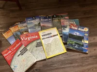
Still have detailed atlases (showing every fire road, logging road, and dirt road) for a couple states and my kids gave me a brand new Atlas for the 50 states as a Christmas gift. Real maps have their place. GPS is nice, but it lacks detail and doesn’t show the whole picture the way a map can.

")
