Consistently the most dangerous stretch of Interstate in the USA Fall- Winter- Spring- I80 Wyoming

GON

$150 Site Donor 2025
Joined
Nov 28, 2014
Messages
10,565
Location
White Sands, NM
The stretch of Interstate on I80 from Evanston, WY to Cheyenne, WY has to be the worst stretch of Fall- Winter- Spring driving in CONUS on a regular basis. I have driven all over the USA for decades in bad weather. Drove mountain passes in Afghanistan. , All of Alaska. I70 Denver to Grand Junction... yawn....Donner pass, easy as eating a pancake compared to I80 in Wyoming.

The reason this is so crazy dangerous is the winds. Near CAT 1 hurricane force winds on a REGULAR basis. The causes any moisture to be a major accident waiting to happen. Add all the dynamic road grades, curves, and lack of visibility. Just insane.

I have been stuck at least 10 times a minimum of 12 plus hours on this stretch of I80 over the past three years. It can get crazy bad in October. I have seen mile after mile of small trailers forced off their tow vehicle and the shoulder being a "trailer graveyard".

I am a big proponent of going an extra 100-200 miles and bypassing I80 in Wyoming if feasible.

If you ever are taking (or planning on) I80 through Wyoming in the Fall- Winter- Spring, highly recommend monitoring the web-site every 30 minutes:

https://wyoroad.info/pls/Browse/WRR.RoutesResults?SelectedRoute=I80
 
Last edited:
I've done I25 from Douglas to Denver several times, summer, fall and winter. Harrowing. I last did the drive from Gillette to Denver in the dead of winter in 1994. From Wheatland to Cheyenne, huge number of semis laying over in the ditch, with snow drifting against them. Some guys found ranch roads to pull off onto, and faced their trucks into the wind. The drifts were so deep in places, I know if I had slowed down, I would've ground to a stop and been stuck. Thinking back, it was pure luck I made it to Cheyenne without getting stuck, or getting hit. Around Iron Mountain, it turned to a solid sheet of ice and the snow let up. Steering wheel felt very light and disconnected for a long stretch. You dare not get into a situation where you needed to brake, because it was useless. The wind tried very hard to put me in the median that day and I used a tank of gas on that 250 mile drive (1993 Sundance).

I don't remember doing I80 into Cheyenne, but my family drove all over that state between 1979 and 1990 from numerous family visits from Florida, showing them all the sights Wyoming had to offer. We were probably on that road at some point, but it would've been summer.

Don't miss it. Even after 26 years.
 
Combine a very high number of steering wheel holders behind the wheel of 18-wheelers and challenging weather conditions and its a recipe for major issues. Watch some of the videos from major pileups over the years and a common theme is drivers going way too fast for the conditions.

With current tools like smartphones and the state websites on road conditions, there is zero reason to find yourself in a poor weather conditions unless you either ignore the potential or willingly put yourself there (or the weather forecast completely misses - been there).

When I was a resident of Fort Collins (truckers and others will know this as the City where you take the shortcut between Laramie and Denver - cutting the corner from Cheyenne), winter travel meant paying attention, and having some flexibility in your travel plans. Even today, I;ve modified travel plans at the last second - the most direct route between Denver and Home is via Nebraska, yet the last 4 drives I've not taken I-80 across Nebraska/Iowa due to winter weather... South Dakota and Kansas or the backroads of Northen Nebraska are actually preferred drives anyways - just longer...
 
With current tools like smartphones and the state websites on road conditions, there is zero reason to find yourself in a poor weather conditions unless you either ignore the potential or willingly put yourself there (or the weather forecast completely misses - been there).

As my post recommends, check the wydot web-site every 30 minutes.

I lived under 60 minutes from Evanston, WY. I would monitor the weather, wydot, etc. Things would be "green an dry" when I left home. That meant nothing. Out of nowhere winds would change and the interstate would be dangerous and often followed with a closing.

This 300 mile stretch is that crazy bad. Weather forecasts mean nothing in the Fall- Winter- Spring.
 
I slowly pulled a 12k 32ft travel trailer through there on a nice summer day few years back. The wind was massive plus the 18 wheelers doing 90 and passing like they were driving a Ferrari crazy. Definite pucker factor and wont do that again.
 
A friend of mine in Casper advises that US 30 is a better winter route between Walcott and Laramie. Lower grades and less windy, IIRC.

I now see that someone has written a book about this stretch of the road:

41lWAMeTxGL.jpg
 
I guess I don't find the road intimidating at all, even in winter. I drive it probably 15-20 a year heading to SLC and West. The Lincoln Highway originally picked this route for its easier to climb grades and direct route. With the exception of US 30 through Hanna vs Elk Mountain, that still holds true today. Yes, it's windy and the ground blizzards are fierce, but being prepared lessens the "scary" feeling of the road. It doesn't have the ski traffic of I-70, nor the tight turns and grades between Summit County and Denver.
 
I guess I don't find the road intimidating at all, even in winter. I drive it probably 15-20 a year heading to SLC and West. The Lincoln Highway originally picked this route for its easier to climb grades and direct route. With the exception of US 30 through Hanna vs Elk Mountain, that still holds true today. Yes, it's windy and the ground blizzards are fierce, but being prepared lessens the "scary" feeling of the road. It doesn't have the ski traffic of I-70, nor the tight turns and grades between Summit County and Denver.

All true and correct. Weather is not crazy for 9 months straight... and the route was picked for multiple reasons. Can it be bad at times - yes.

Being prepared and preplanning your route to account for potential weather - even adjusting dates of travel were the tools of the trade 20+ years ago, and still are - just with better tools in hand today...
 
Last time I took 80, it was closed at Evanston for days due to a crash in Utah. Took a long scenic ride to get around into Utah and then west bound again.
 
Last time I took 80, it was closed at Evanston for days due to a crash in Utah. Took a long scenic ride to get around into Utah and then west bound again.

I would like to take that same drive and sight see that area of the country.
 
I would like to take that same drive and sight see that area of the country.
There actually is a awesome route to Park City, routing from Green River/ Rock Springs to Vernal and over to Park City.

Below is a picture I took on that route. Just pulled over to take it, not any special find. It is that awesome. I think I took this after just crossing the border from Wyoming into Utah.

IMG_20200819_152752.webp
 
Interesting. When going from Park City to Casper we took the 287-220 missing that section of the 80. It was September but interesting and remote countryside. We were curious how bad it got in winter.
 

Attachments

  • 588D68D2-FF6B-4A59-BB9E-2F84600130A4.webp
    588D68D2-FF6B-4A59-BB9E-2F84600130A4.webp
    28.4 KB · Views: 31
Interesting. When going from Park City to Casper we took the 287-220 missing that section of the 80. It was September but interesting and remote countryside. We were curious how bad it got in winter.
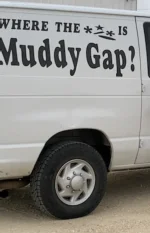
Some of that interesting and remote country was the Great Divide Basin between Rawlins and Muddy Gap. The Continental Divide splits around the basin, and what little precipitation it gets stays there. I hit it right near sundown once in late summer, gold light over everything and nobody around but me and the pronghorns.

On the other hand, I knew somebody who grew up in Rawlins during the 60s and 70s. Her family would sometimes take in stranded travelers for the night when the road was closed and hotels were full.
 
Last edited:
Combine a very high number of steering wheel holders behind the wheel of 18-wheelers and challenging weather conditions and its a recipe for major issues. Watch some of the videos from major pileups over the years and a common theme is drivers going way too fast for the conditions.

With current tools like smartphones and the state websites on road conditions, there is zero reason to find yourself in a poor weather conditions unless you either ignore the potential or willingly put yourself there (or the weather forecast completely misses - been there).

When I was a resident of Fort Collins (truckers and others will know this as the City where you take the shortcut between Laramie and Denver - cutting the corner from Cheyenne), winter travel meant paying attention, and having some flexibility in your travel plans. Even today, I;ve modified travel plans at the last second - the most direct route between Denver and Home is via Nebraska, yet the last 4 drives I've not taken I-80 across Nebraska/Iowa due to winter weather... South Dakota and Kansas or the backroads of Northen Nebraska are actually preferred drives anyways - just longer...
Too fast for conditions, especially “professional” truck drivers is a big issue. Encountered a lot of nasty weather on the PA/OH/IN turnpikes, and the trucks driving way too fast make it massively worse. Rain or snow.
 
Did I80 from Nebraska to Sacramento this summer. Alot of sections I can see being a mess. When we took I40 from Oklahoma to California not much different. Either route is treacherous.. my hats off to any that travels through the mountains on a regular basis. .
 
I-4, Tampa to Daytona. Most dangerous road year round.
Driving CRAZY even though bumper to bumper. (And we don’t even have the foreign tourists yet who drive by the laws of the country they are from)
Die 4 is one of the be worst interstates I have ever driven. And I drive a lot
 
Back
Top Bottom